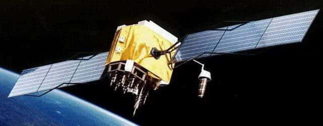
GPS satellite grid is maintained by Unites States Government and it gives as a free service to the public. The Global Positioning System provides facility of giving the information details of a certain place under any condition of weather. More than 30 GPS satellites located around the earth helps to calculate the exact position. US government understood the less importance of functioning this only in their country and then they made it available worldwide.

It has a lot of advantages. The best thing is that it gives us an accurate idea about a position of some object or a person. That feature of the Global Positioning System can be used for so many applications and already done by several people. Another advantage of this Global Positioning System is that it gives us whole details about the location with a lot of details such Altitude etc.
Technology
The Global Positioning System is a system which has a group of satellites in earth orbit that transmit precise signals, it allows GPS receivers to calculate and display accurate information about the location, time and speed to the person who is using the application. The GPS receiver is designed to calculate the location of the receiver based on the singles received using Mathematical formulas.
The way how Global Positioning System works is simple. Each satellite transmits a unique signature as the signal. That signature consists of the position of each satellite. When there is a need of calculating a place, at least four satellites transmit signals to the object and calculate the time taken to receive that signal back. With the time and the speed of the signal, the distance is measured. At least a GPS unit needs to have four channels To be able to lock onto four signals. Most of the units have 12 channels. Calculations were made for the orbits necessary for each of the 31 satellites. As the orbit has 360 degrees in it, at least 6 satellites are visible to any place on the earth.GPS can be used in any type of weather and they are used on land, air, and in water.
Applications
There are so many devices made with the implementation of Global Positioning System. Google Earth is the most famous application that uses the signals received by the GPS receivers. It enables public also to access the maps which tell the users about the locations all around the world.3DEM is freely available software that will create 3D terrain scenes and flyby animations and export GIS terrain data files using any of the following freely available terrain data as a source.People use Global Positioning System for several uses. A research published on a magazine states that the percentage of uses for each several requirement is as follows.
- Car navigation 37%
- Hand held 26%
- Tracking 10%
- GIS 8%
- Survey 7%
- Manufacturing 7%
- Vessel Voyage 2%
- Military Related 1%
United States and European countries show a rapid growth in using GPS for the car navigations and the number of GPS equipped mobile phone usage. Those facts prove that the Global Positioning System helps many people in many other ways.
Navigators
Navigation applications are the most famous GPS applications. The latest releases of those applications allow users to have much advanced features and facilities.
DeLorme Street Atlas 2010: This is software that enables users to do things like trip planning, GPS navigation and mapping. This was much harder to learn how to work with it with the software. It is said that the latest edition has removed that complexity and made it easy for the users to use.
Gramin nRoute: This is free software that enables laptop users to make their work easy with the GPS maps. However, users must already have a MapSource product running on your computer for nRoute to work.In addition to those Microsoft AutoRoute and Streets and Tips are some of the other famous applications.
Tracking
A tracking applications are not that much popular as the navigation applications. But, so many people take uses of them. It enables users to find a location of any object that is tagged with a system.
Top Grossing Apps on iTunes: iPhone users can have this facility through the iTune store. This made the iPhone look much smart in its words.
LOCiMOBILE Apps for tracking people: This enables iPhone users to track people in a particular place at a particular time.
GPS Tracking Lite v2.0 is taking the nation by storm: GPS Tracking v2.0 by Locimobile is their biggest update to date application and it includes much advanced features than the others.
Auto pilot Applications
An auto pilot application is software that enables a vehicle to travel automated with the GPS map. These have been tested and made so many applications where the accuracy is also high.
Future of GPS Applications
There can be several further implementations also as this GPS has become widely available. This can be used to provide a solution for the deforestation. The green plant density of a certain area can be calculated or estimated. With a comparison and analyze, the deforestation rate can be calculate and can ask the officials to pay their attention on those areas.
Cultivation also can be helped with this Global Positioning System. The empty lands can be explored and let the people to cultivate on those areas is something that can help the people to improve their production and the right place for the right product will be available through this system.
The functioning of the currently available GPS is at a very low level. This can be developed with advanced features that could be able to find the areas where marijuana cultivated likewise. The cameras should be much more sensitive to identify such objects. The research things will be easy if that kind of facility can be established. The application developers will have much advanced API for their development that can give a greater outcome.
Other Satiate Grids
IRNSS
It is named as Indian Regional Navigation Satellite System which will be released by 2014 as it was approved by the government in 2006. This will be fully control of the Indian government. This will be totally base on India.
QZSS
Quasi-Zenith Satellite System (QZSS) is to be developed by Japan for their GPS coverage.
References
- Forssell, P. B. (2009). The dabgers of GPS/GNSS. Coordinates , 6-10.
- Hlavac, M. (2007, October 11). List of laptop GPS navigation software programs and review. Retrieved May 16, 2010, from laptop gps world: http://www.laptopgpsworld.com/37-list-laptop-gps-navigation-software-programs-reviews
See Also
Bookmark


